
District 2
Serving Downtown, Gerstle Park, West End, Sun Valley, Bret Harte, Fairhills, Lincoln / San Rafael Hill, and Picnic Valley.
Helping residents understand the issues, projects, and decisions shaping District 2 while connecting them to official City information.
District Priorities
Understand the long term issues Shaping District 2.
Current Projects
Follow major projects currently underway.
City Resources
Find City meetings, project pages, neighborhood information, and service requests.
Previous Compass Editions
Browse previous monthly editions
District Maps
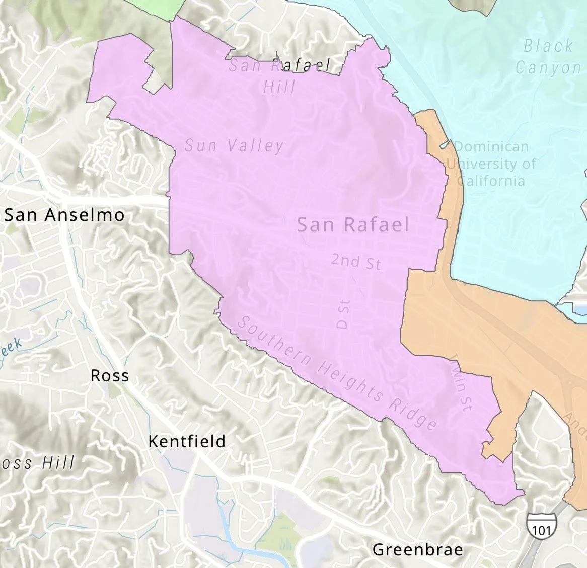
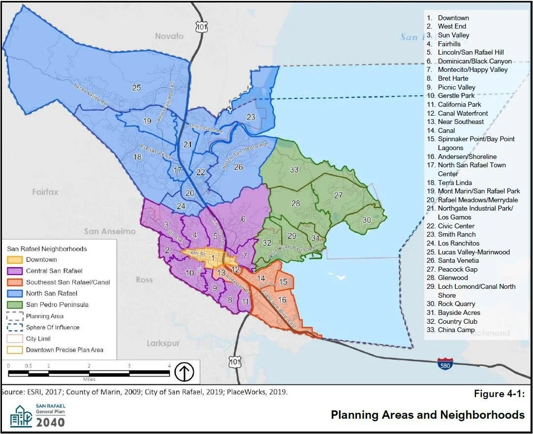
District 2 includes Downtown and several of San Rafael’s historic neighborhoods. The maps below help illustrate the relationship between the City Council district and the City’s neighborhood planning areas.
District Election Boundary
The pink shaded area represents San Rafael City Council District 2
Neighborhood Planning Areas
District 2 includes portions of several neighborhood planning areas. Understanding both maps helps explain how projects may affect nearby communities.
About This Guide
The District 2 Guide is intended to help residents better understand the issues, projects, and priorities affecting our neighborhoods.
Rather than duplicating information already available on the City of San Rafael website, this guide provides context, highlights opportunities for community participation, and links directly to official City webpages for agendas, project updates, staff reports, and additional information.
My goal is simple: make it easier for District 2 residents to stay informed and engaged.